
Zoom Earth is your go-to interactive weather map and real-time hurricane tracker, designed to keep you informed about hurricanes, typhoons, and tropical cyclones as they happen. With an array of features such as satellite imagery, rain radar, weather forecast maps, hurricane tracking, wildfire tracking, and extensive customization options, Zoom Earth is your comprehensive tool for weather monitoring.
Key Features
Satellite Imagery: Experience the world's weather through Zoom Earth's near real-time satellite imagery sourced from top agencies like NOAA GOES, JMA Himawari, EUMETSAT Meteosat, and NASA's Aqua and Terra polar-orbiting satellites.
Rain Radar: Stay one step ahead of the storm with our detailed weather radar map, which provides real-time updates on rain and snow using ground-based doppler radar.
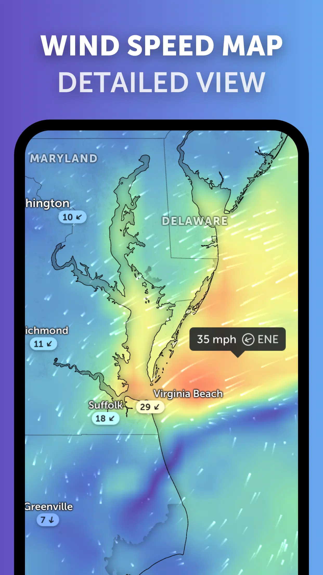
Weather Forecast Maps: Dive into stunning, interactive weather visualizations with our global forecast maps. These include detailed forecasts for precipitation, wind speed and gusts, temperature, "feels like" temperature, relative humidity, dew point, and atmospheric pressure.
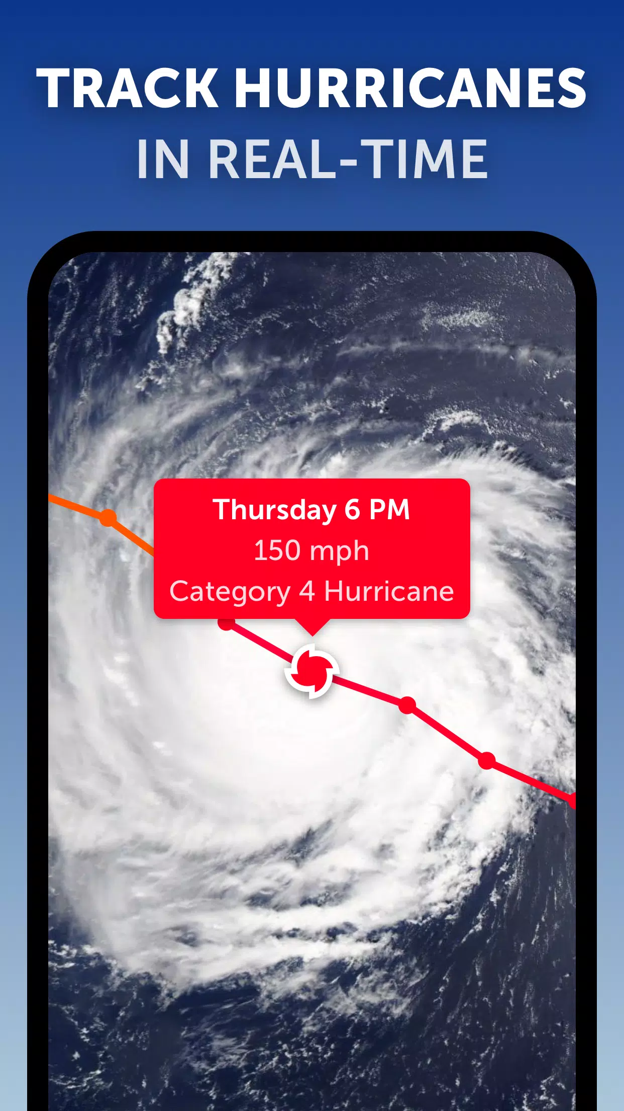
Hurricane Tracking: Keep a close eye on hurricanes from their inception to their peak at category 5 with our state-of-the-art tropical tracking system. We utilize the latest data from NHC, JTWC, NRL, and IBTrACS to bring you accurate, real-time updates.
Wildfire Tracking: Stay informed about wildfires with our active fires and heat spots overlay, which uses daily updates from NASA FIRMS to show high-temperature points detected by satellite.
Customization: Tailor your experience with Zoom Earth by adjusting temperature units, wind units, time zones, animation styles, and more through our comprehensive settings menu.
What's New in the Latest Version 3.1
Last updated on Sep 19, 2024
- Enhanced clarity when viewing multiple tropical systems simultaneously.
- Separate alert notifications for Atlantic and Eastern Pacific systems.
- Improved readability with updated map labels.


3.1
28.5 MB
Android 8.0+
com.neave.zoomearth