Ensure safe drone operation in any weather with our essential mobile app. Before launching your quadcopter, DJI drone, or other UAV, utilize our comprehensive air map and weather forecasting tools.
This must-have app is perfect for both drone enthusiasts and professional pilots, prioritizing safe deployment. Check real-time weather conditions and identify no-fly zones to minimize risk. Enjoy peace of mind with your UAV, RC aircraft, or DJI drone flights.
Our app provides crucial flight information:
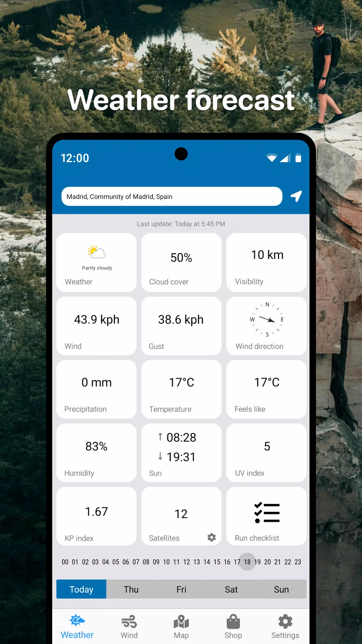
- Detailed real-time weather forecasts for your chosen area.
- Hourly and 3-day forecasts.
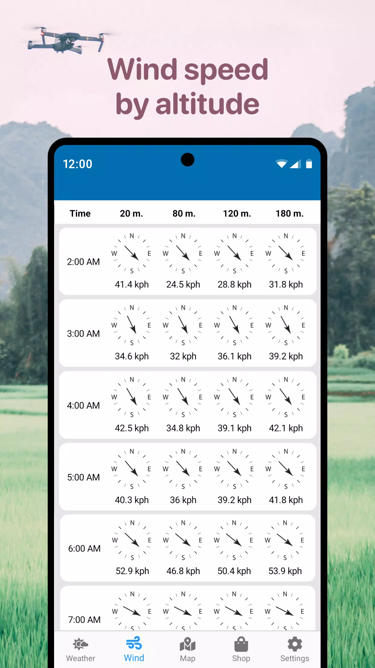
- Wind speed, maximum gusts, direction, and altitude-specific details.
- Sunrise and sunset times.
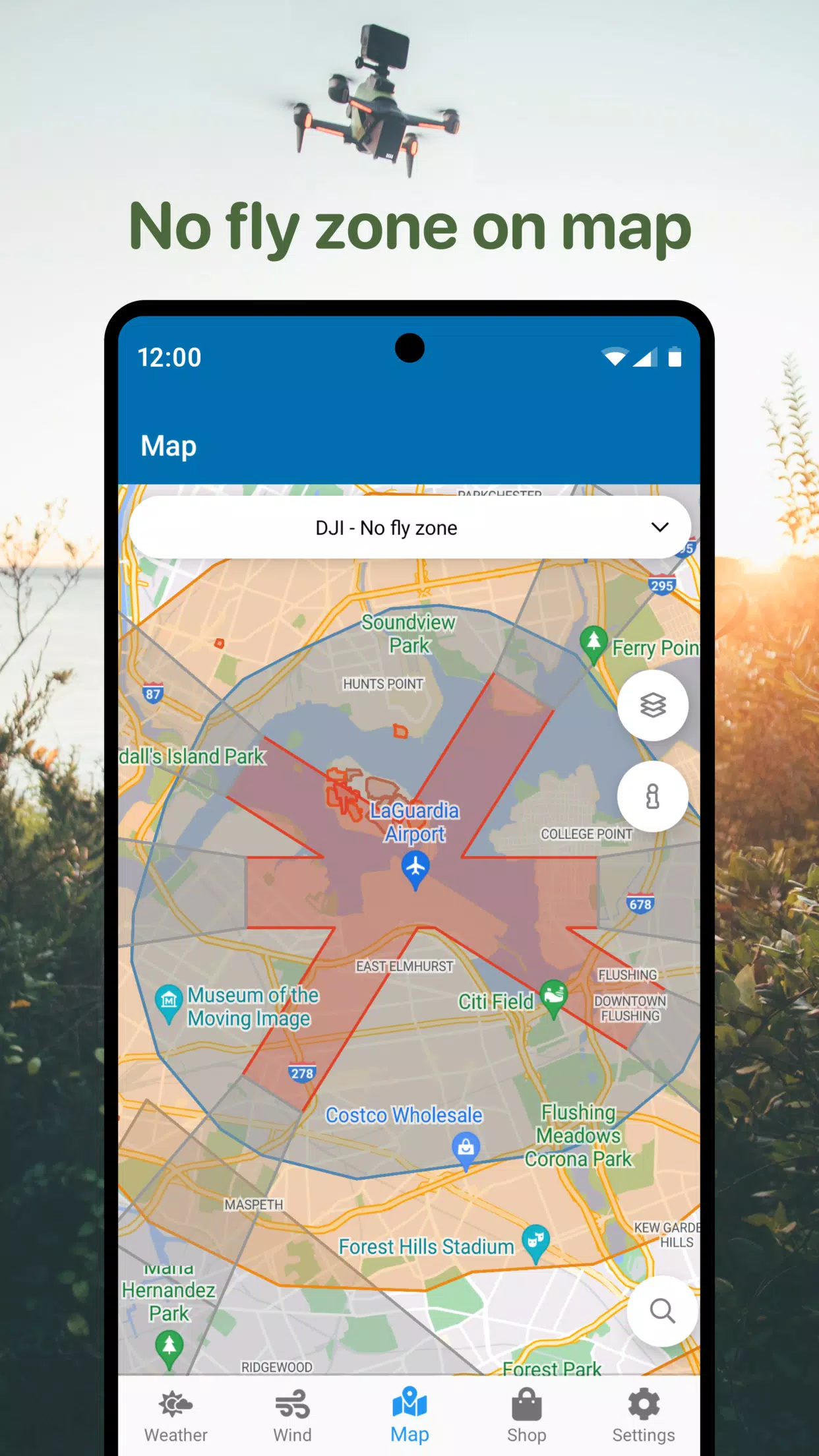
- An integrated no-fly zone air map.
- A compass to determine wind direction.
- Other helpful parameters for DJI and various other drone models.
Utilize the no-fly zone map to identify safe airspace for your quadcopter. Avoid airports, heliports, and areas marked in red. Our app is your ideal assistant for safe drone operation, helping you avoid unfavorable weather and restricted zones. Quickly access essential data for efficient flight planning. This includes wind forecasts for UAVs and a detailed no-fly zone map.
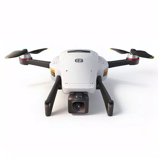
This universal tool supports a wide range of drones, including DJI Mavic, DJI Phantom, Inspire, DJI Mini, DJI Air, Spark, Parrot Bebop, Xiaomi, Autel, Walkera, Yuneec, Hubsan, FIMI, Syma, Volocopter, Skydio, and other UAVs.
Download the app today for confident and safe drone operation.
Version 1.4.5 (Updated October 22, 2024)
- Performance improvements.