
Effortlessly manage your KML/KMZ/GPX files with MAPinr, a comprehensive GIS tool that also offers measuring capabilities, GPS logging, WMS support, and offline maps. At MAPinr, we understand the rapid evolution of Android versions can pose challenges for non-profit projects like ours. Despite these hurdles, we're committed to keeping MAPinr alive, ensuring it remains a secure, privacy-friendly, and affordable app for all users.
We recognize that newer Android versions may not be compatible with all devices. That's why we provide download options for older Android versions (below Android 14), which are no longer supported by the Play Store, directly on our website.
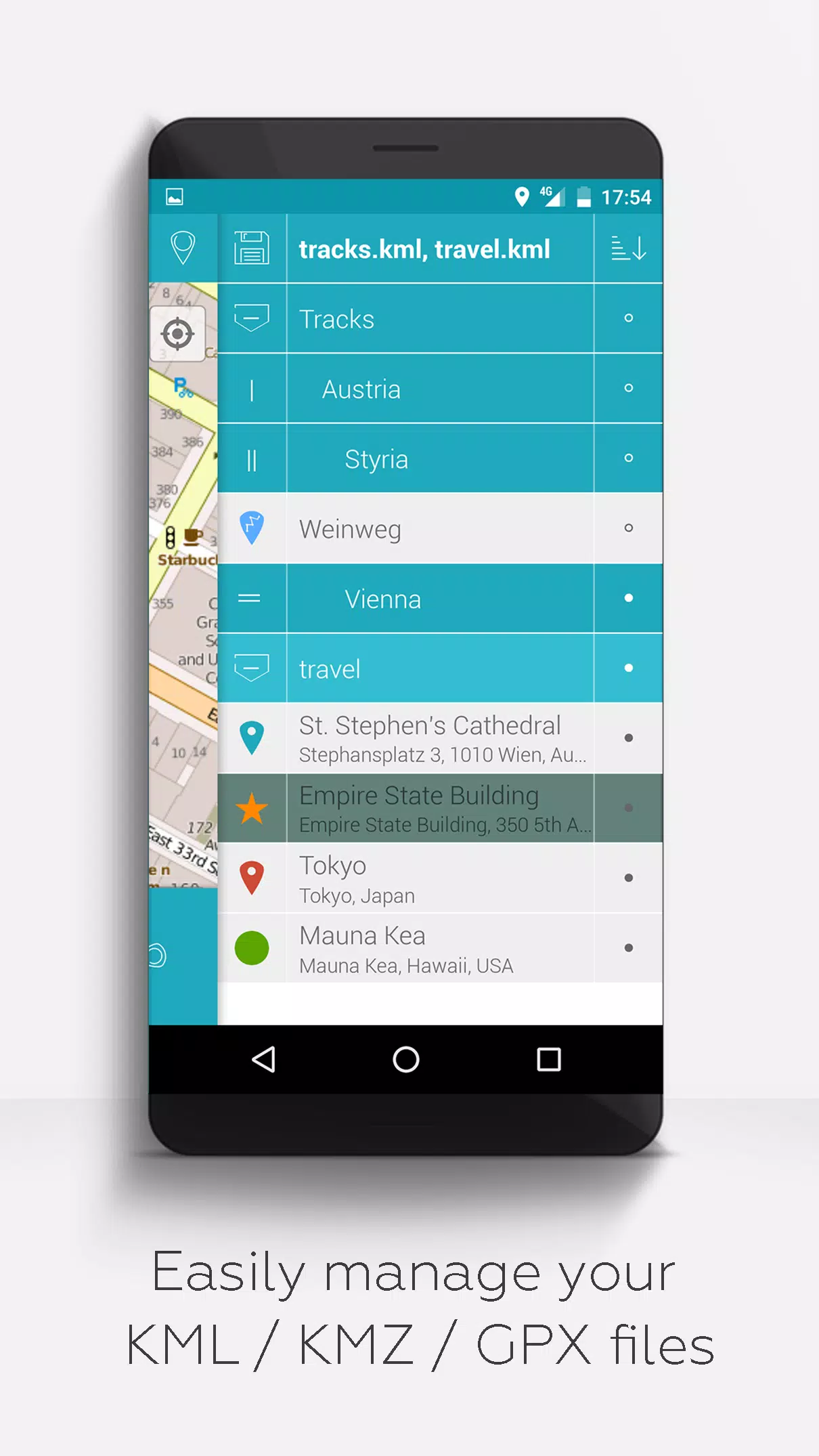
Are you looking to view and manage your personal points of interest or perhaps place your photos on a map? MAPinr is your go-to solution. This ad-free Android app enables you to efficiently manage your KML/KMZ files and display GPX files on various maps, making it ideal for professionals as well as enthusiasts in hiking, cycling, running, skiing, and more.
We value your feedback and welcome your suggestions for improving MAPinr. Feel free to reach out with your ideas or concerns at [email protected]. We appreciate your patience and understanding, as our limited resources mean we can't implement every suggestion immediately. Please keep your feedback constructive; we're all in this together to make MAPinr better.
MAPinr offers an array of features designed to enhance your mapping experience:
- Ad-Free Experience: Enjoy an app free from intrusive ads.
- Organized File Management: Use a hierarchical folder structure to manage multiple KML/KMZ/GPX files.
- Comprehensive KML/KMZ Handling: Create, load, edit, save, import, export, and share KML/KMZ files with ease.
- Versatile Geo-Object Management: Create, load, edit, save, import, export, and share waypoints, lines/tracks, and polygons.
- Photomap Integration: Add pictures to your waypoints to create personalized photomaps.
- Multi-Map Display: Display waypoints, lines/tracks, and polygons on various maps including Maps, Satellite, Hybrid, OpenStreetMap, Opentopomap, and Opencyclemap.
- Coordinate Sharing: Share the coordinates of your waypoints with others.
- Custom Colorization: Individually colorize waypoints, lines/tracks, and polygons for better visualization.
- Inter-App Compatibility: Open exported KML/KMZ files in other apps.
- Advanced Search: Search by name, address, and coordinates to quickly find what you need.
- Location Sharing: Let your friends know where you are with location-sharing features.
- Multi-File Display: Display multiple KML/KMZ/GPX files simultaneously for a comprehensive view.
- File Merging: Merge KML/KMZ files to streamline your data.
- Cloud Integration: Easily integrate with cloud services for seamless data management.
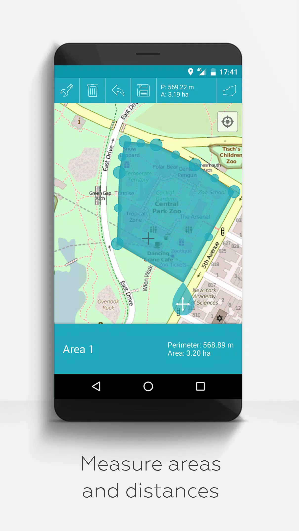
- Measurement Tools: Measure distances and areas directly on your map.
- Multilingual Support: Available in English, Spanish, Lithuanian, and Polish.
For those who support us with donations or a like on LinkedIn, you can unlock extended features in the app settings:
- Offline Maps: Download OpenStreetMap tiles for free and access them offline.
- GPX Viewer: View GPX files without additional costs.
- WMS Support: Display arbitrary map data using Web Map Service, including Opendata from www.data.gov.
- Custom Metadata: Create custom metadata to fit your specific needs.
- Custom Icons: Upload and use your own icons for a personalized experience.
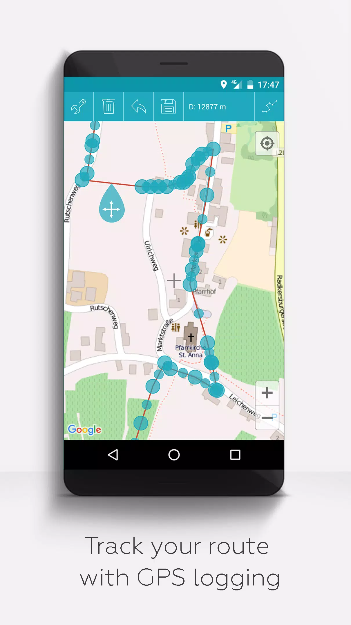
- GPS Track Recording: Record your GPS tracks directly within the app.
Unlike other apps, MAPinr respects your privacy and does not collect or sell your data. Your donations are a voluntary contribution to support our non-profit mission. Thank you for choosing MAPinr!
4.1.2
76.3 MB
Android 6.0+
at.xylem.mapin
Great app for managing KML and GPX files! The offline maps and GPS logging are super useful for hiking. Could use a slightly more intuitive UI, but overall solid.