
2GIS offers a comprehensive mapping and navigation solution that's perfect for both drivers and pedestrians. With detailed maps, GPS navigation, live traffic updates, parking information, and transit routes, 2GIS ensures you're never lost, even without an internet connection. Whether you're exploring a new city or navigating your hometown, 2GIS makes you feel right at home with its extensive features.
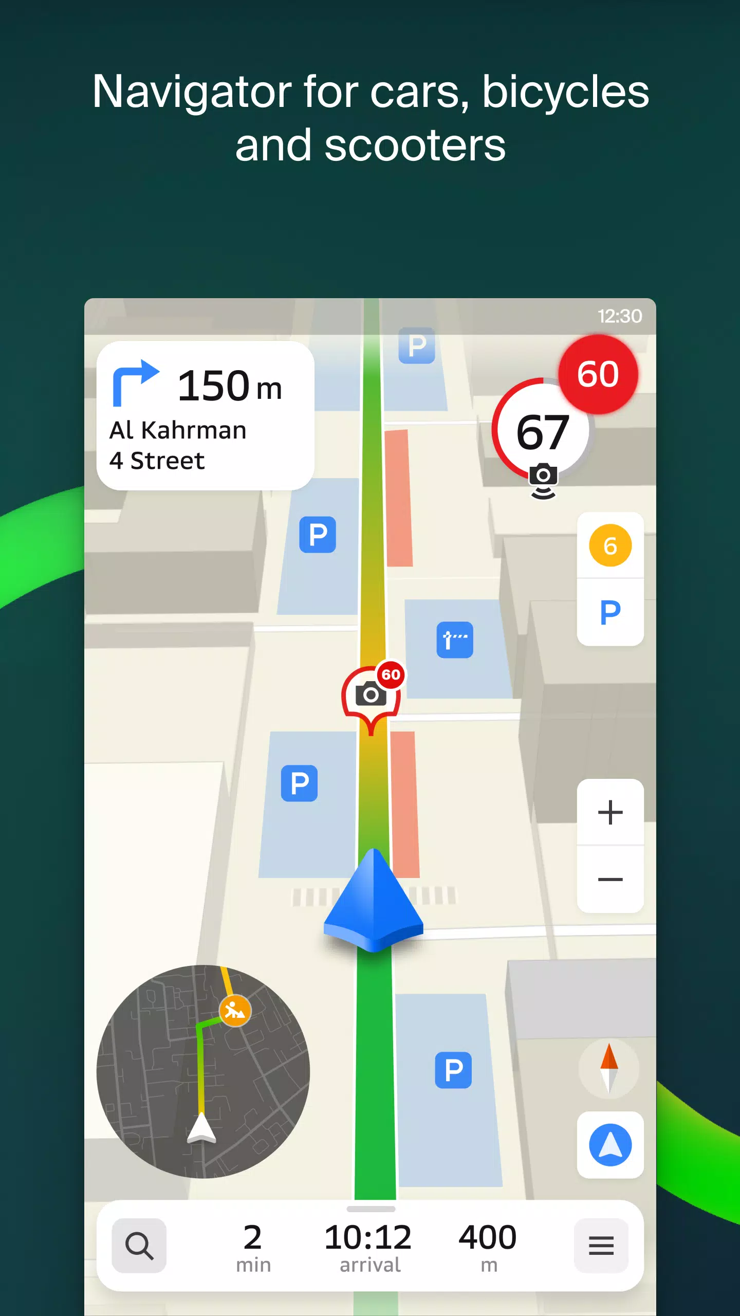
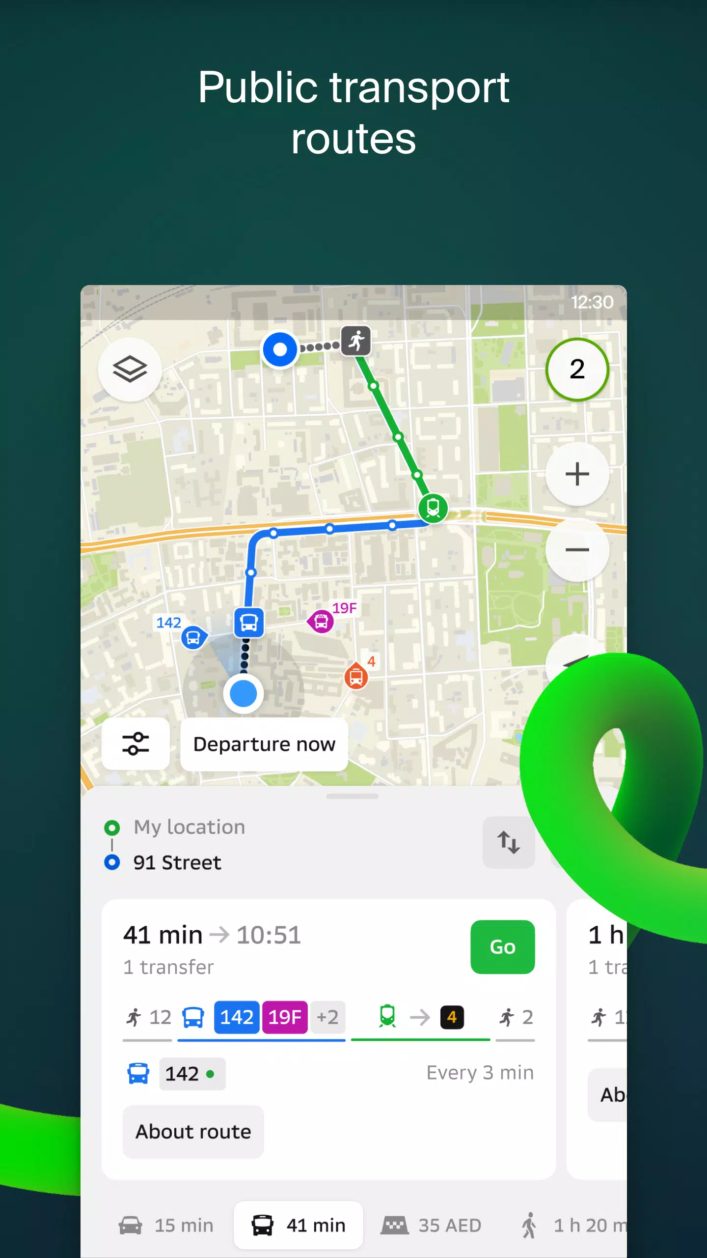
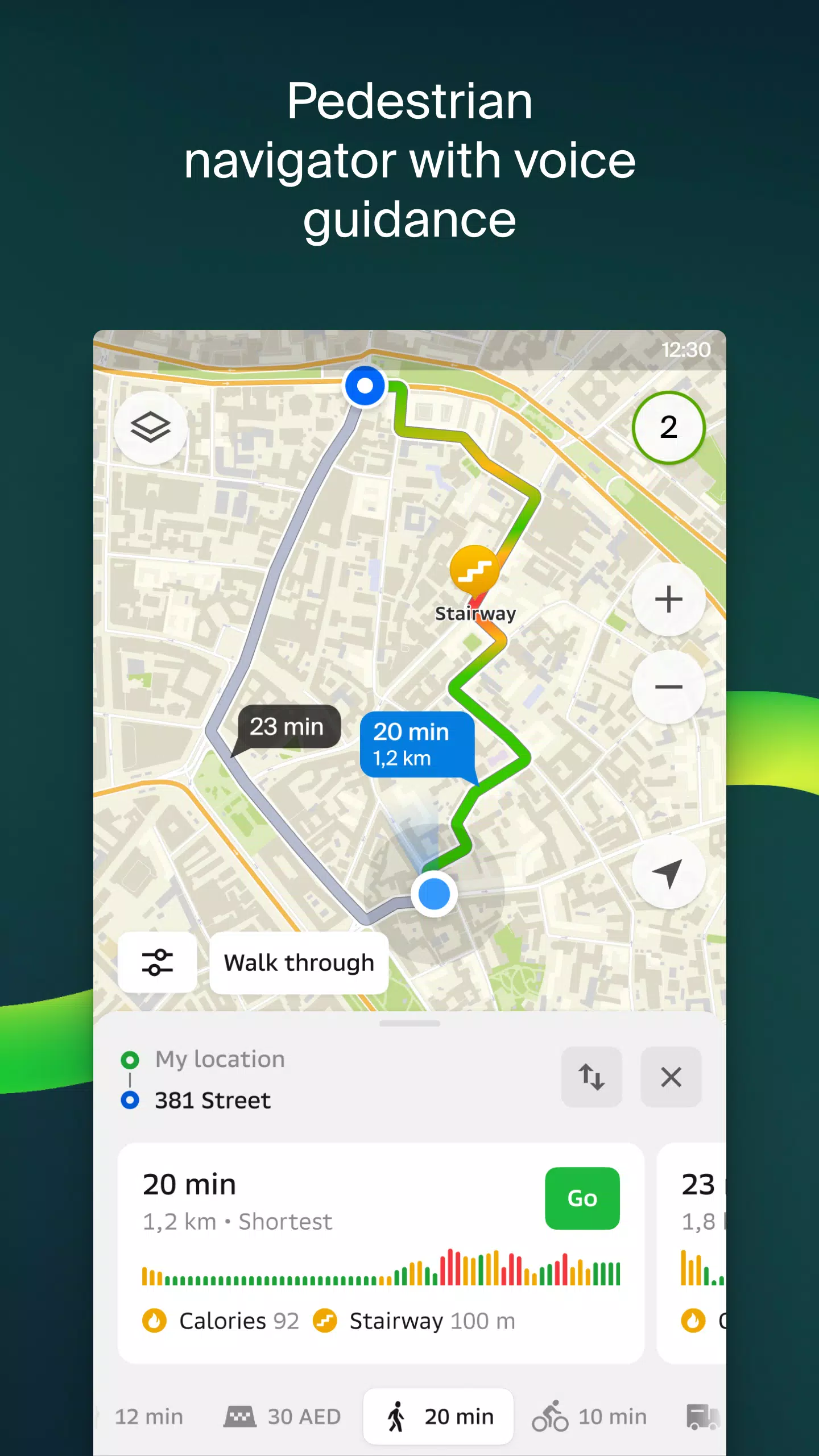
Easily locate addresses, businesses, phone numbers, operating hours, products, or services. Navigate to your destination by car, bus, subway, or on foot, with clear guidance to building entrances and nearby parking spots. 2GIS provides accurate maps that pinpoint districts, buildings, streets, bus stops, subway stations, gas stations, sports facilities, and more.
Utilize GPS navigation that takes into account real-time traffic conditions, road signs, speed cameras, toll roads, and unpaved routes. Plan routes between cities or through multiple points. 2GIS also offers a free app compatible with Android Auto for an enhanced driving experience.
Stay connected with friends and family through the live friends' location feature on the map. Track the GPS location of your loved ones to ensure their safety, send fun stickers, and view their battery levels. You have control over who you add as friends and with whom you share your location, with flexible sharing settings.
Stay informed about road events, including accidents, blocked streets, and speed cameras, with user comments directly on the map. 2GIS also provides detailed public transport information, including timetables and real-time routes.
For pedestrians, 2GIS offers walking routes with background operation and voice guidance. For truck drivers, the cargo navigator tailors directions based on your vehicle's and cargo's specific characteristics.
Explore the detailed directory to find addresses, entrances, postal codes, phone numbers, operating hours, social media links, websites, and user-added photos and reviews of businesses. Use 2GIS as your travel guide to discover major attractions and Wi-Fi hotspots.
Enhance your navigation experience with the 2GIS Notifications companion app for smartwatches on Wear OS. This app provides route guidance for walking, biking, or using public transport directly from your wrist, with vibration alerts for turns and destination arrivals. It starts automatically when you initiate navigation on your phone and is compatible with Wear OS 3.0 or later.
2GIS covers numerous cities across the UAE, Russia, Belarus, Kazakhstan, Uzbekistan, Azerbaijan, and Kyrgyzstan, including Dubai, Sharjah, Abu Dhabi, Moscow, Saint Petersburg, Minsk, Almaty, and many more.
For any support, reach out to [email protected].

6.44.1.559.3
180.4 MB
Android 6.0+
ru.dublgis.dgismobile